Last updated: August 2026 — Written by Cyman Travel, INGUAT-certified local agency in Antigua Guatemala.
Quick Answer
Guatemala has 37 officially recognized volcanoes, of which 3 are constantly active — Fuego, Pacaya, and Santiaguito — and monitored 24/7 by INSIVUMEH, Guatemala’s national volcanology institute. Guatemala is home to the highest volcano in Central America (Tajumulco, 4,203 m) and one of the most active volcanoes on Earth (Fuego, with 79 recorded eruptions). You can hike two of the three active volcanoes from Antigua Guatemala with a local guide.
Guatemala’s relationship with its volcanoes is unlike anything else in Central America. 37 volcanic peaks stretch across the country from the Mexican border to the Salvadoran frontier, following the Pacific coastline along the Central American Volcanic Arc — a chain of volcanoes created by the subduction of the Cocos Plate beneath the Caribbean and North American plates, part of the same geological system that produces earthquakes and eruptions along the entire Pacific Rim.
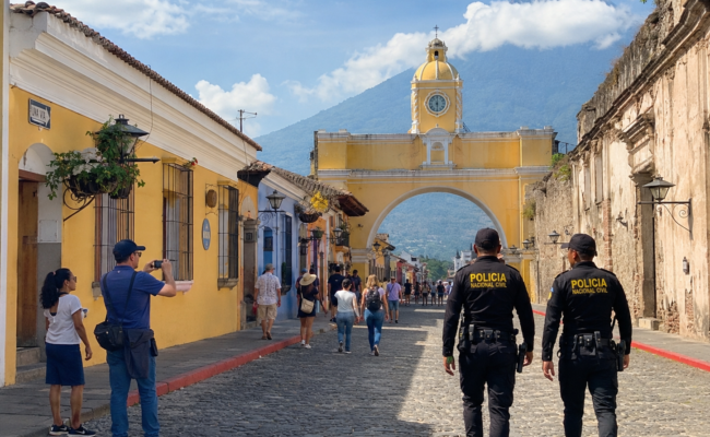
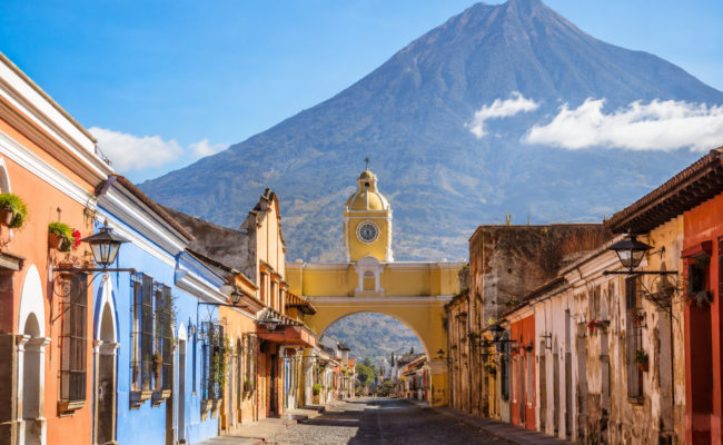
For travelers, this means something remarkable: from the colonial streets of Antigua Guatemala, you can see three volcanoes simultaneously, hike two active ones on day trips, and spend the night above the clouds watching a fourth erupt in real time. No country in the Americas offers this concentration of accessible, dramatic volcanic experience.
📲 Hike Guatemala’s volcanoes with local experts
Cyman Travel operates Acatenango overnight treks and Pacaya day hikes daily from Antigua. INGUAT-certified guides. Private transport. 24/7 support.
Acatenango overnight: from $85/person · Pacaya day hike: from $35/person
📲 WhatsApp: +502 3468-0911 — available 24/7
Guatemala's 37 Volcanoes — The Complete Picture
According to the Smithsonian Institution’s Global Volcanism Program and INSIVUMEH, Guatemala’s 37 recognized volcanoes fall into three categories:
- 3 constantly active volcanoes — erupting regularly and monitored 24/7: Fuego, Pacaya, and Santiaguito
- Dormant volcanoes — capable of erupting but not currently active: Acatenango, Santa María, Agua, Tolimán, Atitlán, San Pedro, Tajumulco, and others
- Extinct volcanoes — no eruption in recorded history and unlikely to erupt again
Guatemala sits on the convergent boundary of three tectonic plates — the Caribbean, North American, and Cocos plates — creating one of the most geologically volatile environments on Earth. The country’s volcanic chain runs roughly parallel to the Pacific coast through the Guatemalan highlands, with peaks rising dramatically above densely populated valleys, ancient Maya cities, and the country’s most visited tourist destinations.
The 3 Constantly Active Volcanoes of Guatemala
1. Volcán de Fuego — The Most Active Volcano in Central America
Elevation: 3,763 meters (12,346 feet)
Location: 16 km southwest of Antigua Guatemala
Status: Continuously erupting since 2002
Fuego is one of the most persistently active volcanoes in the Western Hemisphere — with 79 recorded eruptions dating back to 1524, more than any other volcano in Guatemala and among the highest counts in the entire Smithsonian Global Volcanism Program catalog. Since January 2002, Fuego has been in a single continuous eruptive phase, producing 4 to 12 Strombolian explosions per hour, with periodic paroxysmal episodes — intense multi-day eruptions with pyroclastic flows, lava fountains reaching 200–300 meters above the crater, and ash columns rising 5,000 to 7,000 meters.
The most deadly Fuego eruption in modern history occurred on June 3, 2018, when a sudden paroxysmal phase sent pyroclastic flows into the populated valleys below, killing over 200 people in the communities of San Miguel Los Lotes and El Rodeo. The disaster fundamentally changed how CONRED and INSIVUMEH monitor and communicate volcanic risk in Guatemala.
The most recent significant eruption occurred August 3–5, 2026, when Fuego entered a paroxysmal phase that forced the evacuation of 1,699 people and prompted INGUAT to temporarily suspend access to Acatenango. The phase ended on August 5 and access was subsequently restored.
Can you visit Fuego? Fuego itself is not accessible for hiking — its active crater and unpredictable pyroclastic flows make direct access too dangerous. However, Fuego’s eruptions are best observed from Acatenango’s base camp, 7 kilometers away and 200 meters higher — close enough to feel the shockwaves of major explosions and watch lava flows in detail, far enough for safety. Every Acatenango overnight trek is fundamentally a Fuego eruption viewing experience.
2. Volcán Pacaya — Guatemala's Most Accessible Active Volcano
Elevation: 2,552 meters (8,373 feet)
Location: 27 km south of Guatemala City, 90 minutes from Antigua
Status: Active — in continuous eruption since 1965
Pacaya has been in an uninterrupted eruptive episode since 1965 — over six decades of continuous activity. Its primary eruption style is Strombolian: periodic explosions from the MacKenney cone that throw incandescent lava bombs, produce lava flows on the volcano’s flanks, and create the accessible lava fields that thousands of tourists walk across each year.
Pacaya is the most-hiked active volcano in Guatemala — a moderate two-hour trail from the national park entrance leads to the active lava fields, where visitors can feel geothermal heat through their boots, see recent lava flows up close, and on favorable days, roast marshmallows over volcanic steam vents.
Can you hike Pacaya? Yes — Pacaya is fully open and one of Cyman Travel’s most popular day tours from Antigua. From $35 per person, minimum 1 person. Book the Pacaya day hike →
3. Santiaguito — A Century-Old Lava Dome
Elevation: 2,500 meters (8,200 feet)
Location: Inside the 1902 crater of Santa María volcano, near Quetzaltenango
Status: Active — lava dome eruption ongoing since 1922
Santiaguito is technically a volcanic dome complex growing inside the massive crater created by Santa María’s catastrophic 1902 eruption — one of the largest volcanic eruptions of the 20th century, which ejected over 5 cubic kilometers of tephra in a single explosive event. The Santiaguito dome has been extruding lava and periodically exploding since 1922 — over 100 consecutive years of activity — making it one of the longest continuously active lava-dome eruptions anywhere on Earth.
Santiaguito is best viewed from the summit of Santa María, which offers a dramatic top-down perspective of the dome complex below. Access to Santa María and Santiaguito is possible with an experienced local guide departing from Quetzaltenango.
The Most Important Dormant Volcanoes Near Antigua
Antigua Guatemala sits in a valley surrounded by four volcanoes — three dormant and one active. The image at the top of this post shows the view of multiple volcanic peaks visible from the highlands around Antigua, labeled with their names. Here is what each one is:
Volcán Acatenango — 3,976 meters
Guatemala’s third-highest volcano and the most popular overnight hiking destination in the country. Dormant — its last confirmed eruption was in 1972 — but dramatically positioned as Fuego’s immediate neighbor, making its base camp the best viewpoint for watching Fuego erupt. The overnight trek to Acatenango is the single most memorable experience available to travelers based in Antigua. Full Acatenango guide →
Volcán de Agua — 3,760 meters
The iconic cone that defines Antigua’s skyline — visible from the Central Park, from the rooftops of every hotel, and from the hilltop of Cerro de la Cruz. Agua last erupted in pre-Columbian times and is considered extinct for practical purposes. Its near-perfect conical shape makes it one of the most photogenic volcanoes in Guatemala, and its summit offers panoramic views of Antigua, Fuego, Acatenango, and on clear days, the Pacific coast. Agua can be hiked as a day trip from Antigua.
Volcán Tolimán — 3,153 meters
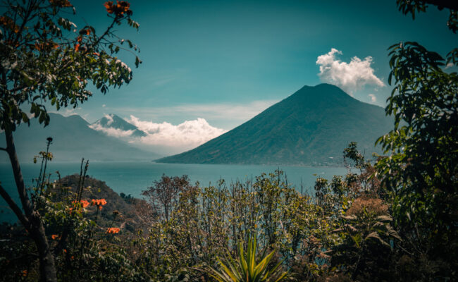
One of the three volcanoes surrounding Lake Atitlán, visible across the water from Panajachel. Tolimán last erupted in the 16th century and is considered dormant. Its distinctive twin summit rises directly from the lake’s southern shore.
Volcán Atitlán — 3,537 meters
The tallest of the three Lake Atitlán volcanoes, rising dramatically behind Tolimán as seen from the northern shores of the lake. Last erupted approximately 1,800 years ago. Its summit offers one of the most spectacular panoramic views in Guatemala on clear days.
Volcán San Pedro — 3,020 meters
The third Lake Atitlán volcano, rising directly above the village of San Pedro La Laguna on the lake’s western shore. A popular day hike from the lakeside village, with a 3-hour ascent offering views across the entire lake and surrounding highlands.
The Highest Volcano in Central America
Tajumulco — 4,203 meters (13,789 feet) is not only the highest volcano in Guatemala but the highest peak in all of Central America. Located in the western department of San Marcos near the Mexican border, Tajumulco is a dormant stratovolcano with no eruption in recorded history.
Tajumulco is a serious mountaineering objective — at 4,203 meters, altitude sickness is a real concern, and the summit requires camping at high altitude. It is typically done as a 2-day expedition from Quetzaltenango. For travelers based in Antigua, Acatenango (3,976 m) offers a comparable high-altitude experience with the added spectacle of watching Fuego erupt throughout the night.
Why Does Guatemala Have So Many Volcanoes?
Guatemala’s extraordinary volcanic density has a single geological explanation: plate tectonics.
Guatemala sits at the convergence of three major tectonic plates. The Cocos Plate — a Pacific oceanic plate — is subducting (sliding underneath) the Caribbean and North American plates at approximately 72–80 millimeters per year. As the Cocos Plate descends into the Earth’s mantle, it melts and generates magma that rises through the overlying crust. Where this magma reaches the surface, volcanoes form.
This subduction process has been operating for millions of years along the entire Central American Isthmus, creating the Central American Volcanic Arc — a 1,500-kilometer chain of volcanoes that runs from Guatemala to Panama. Guatemala sits at the northwestern end of this arc, where the subduction geometry produces the highest concentration and most intense volcanic activity in the chain.
The same geological process also makes Guatemala one of the most seismically active countries in the Americas — major earthquakes are part of the same tectonic system as the volcanic activity.
Guatemala Volcanoes You Can Hike from Antigua — Current Status
All of the following volcano hikes depart daily from Antigua Guatemala with Cyman Travel. Current status as of August 2026:
- 🟢 Acatenango overnight trek — Open. From $85/person. The definitive Guatemala volcano experience. Watch Fuego erupt from base camp throughout the night. Book →
- 🟢 Pacaya day hike — Open. From $35/person. Active lava fields, 90 minutes from Antigua. Guatemala’s most accessible active volcano. Book →
- 🔴 Fuego direct access — Not accessible. No hiking route to Fuego’s active crater due to ongoing pyroclastic hazard. Best viewed from Acatenango base camp.
- 🟡 Volcán de Agua — Accessible as a day hike. Not offered by Cyman Travel directly — ask us for a referral to a local operator.
Ready to experience Guatemala’s volcanoes?
Contact Cyman Travel for Acatenango overnight treks ($85/person) and Pacaya day hikes ($35/person). Daily departures from Antigua. INGUAT-certified local guides.
📲 WhatsApp: +502 3468-0911 — 24/7
📧 reservaciones@cymantravel.com · Browse all tours →
About This Guide
This guide was written by Cyman Travel, a 100% Guatemalan, INGUAT-certified agency based at 6a Avenida Norte 1, Antigua Guatemala. We operate Acatenango overnight treks and Pacaya day hikes year-round, with direct knowledge of current volcano access conditions. Volcano data in this guide is sourced from the Smithsonian Global Volcanism Program, INSIVUMEH, and CONRED official communications.
Last updated: August 2026 by Cyman Travel staff in Antigua Guatemala.
📲 WhatsApp: +502 3468-0911 — available 24/7
📧 Email: reservaciones@cymantravel.com
🌐 Browse all volcano tours from Antigua Guatemala →